
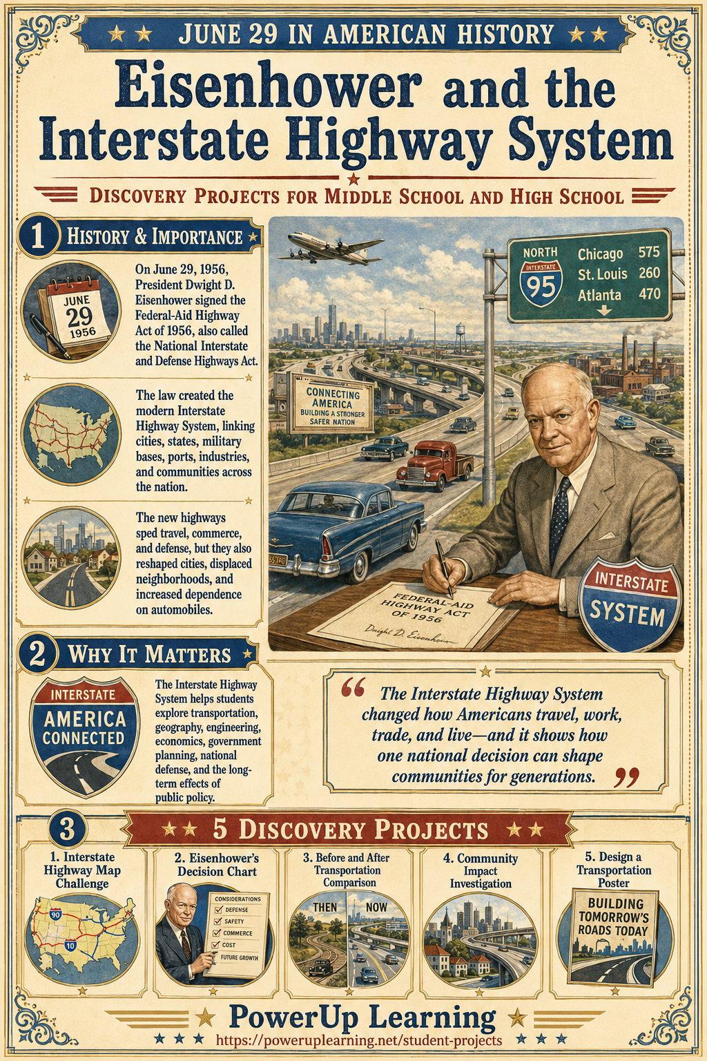
June 29: Eisenhower and the Interstate Highway System
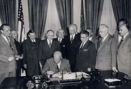
President Eisenhower signing the U.S. Highways Act
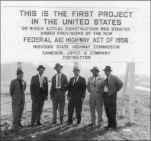
On June 29, 1956, President Dwight D. Eisenhower signed the Federal-Aid Highway Act of 1956, also known as the National Interstate and Defense Highways Act. This law created the modern Interstate Highway System, a network of major roads designed to connect cities, states, military bases, ports, industries, and communities across the United States. At the time, it was one of the largest public works projects in American history.
Eisenhower believed a strong national highway system was important for travel, commerce, safety, and national defense. His thinking was shaped partly by his experience with military transportation, including the difficulty of moving across the United States in a 1919 Army convoy and what he later observed about Germany’s road system during World War II. The 1956 law authorized construction of thousands of miles of interstate highways and changed how Americans moved people, goods, and services across the country.
The Interstate Highway System made long-distance travel faster and helped businesses move products more efficiently. It also supported suburban growth, tourism, trucking, commuting, and emergency transportation. However, the highway system also had serious consequences. In many cities, highways cut through neighborhoods, displaced residents, changed downtown business districts, and increased dependence on automobiles. For students, this topic is important because it shows how one government decision can reshape daily life, the economy, geography, communities, and the environment for generations.
Why It Matters
The Interstate Highway System helps students explore transportation, geography, economics, engineering, government planning, national defense, urban change, and the long-term effects of public policy. It raises important historical questions: How do roads shape the way people live? Why does transportation matter to a nation’s economy and security? How can one public works project create both opportunity and disruption? What should leaders consider before making decisions that change communities?
Discovery Projects
Project 1: Interstate Highway Map Challenge
Project Goal:
Create a map showing how the Interstate Highway System connects the United States.
What to Include:
The map should include at least five major interstate highways, such as I-90, I-80, I-70, I-40, I-10, I-95, I-75, or I-5. Students should label major cities, regions, or states connected by these routes. They should also identify one interstate near their home state or region.
Student Directions:
Research the U.S. Interstate Highway System and choose several major routes to map. Use arrows, labels, and a legend to show how highways connect people, goods, military movement, tourism, and emergency services. Add the date June 29, 1956 and the phrase Today in American History.
Final Product:
A labeled paper or digital map.
Reflection Question:
How does a highway system change the way people understand distance, travel, and connection?
Project 2: Eisenhower’s Decision Chart
Project Goal:
Analyze why President Eisenhower supported a national interstate highway system.
What to Include:
Students should create a chart with at least four reasons for building the Interstate Highway System. Possible reasons include national defense, safer roads, faster travel, economic growth, military movement, trucking, and connection between states. Students should also include possible concerns, such as cost, neighborhood disruption, pollution, traffic, or the decline of some small-town businesses.
Student Directions:
Imagine you are advising President Eisenhower in 1956. Create a decision chart with two sections: Reasons to Build and Possible Concerns. Use historical evidence to explain why the decision was important and why its consequences were complicated.
Final Product:
A decision chart or policy recommendation page.
Reflection Question:
Why should leaders consider both benefits and consequences before approving a major public project?
Project 3: Before and After Transportation Comparison
Project Goal:
Compare American travel before and after the Interstate Highway System.
What to Include:
Students should compare roads, travel time, family vacations, trucking, shipping, small towns, cities, suburbs, and roadside businesses. They may include images or drawings of older highways, gas stations, diners, motels, interstates, suburbs, and delivery trucks.
Student Directions:
Research what long-distance travel was like before interstate highways. Then create a comparison chart showing how travel and transportation changed after 1956. Include at least five categories and explain whether each change was mostly helpful, harmful, or mixed.
Final Product:
A before-and-after chart, poster, or slide.
Reflection Question:
What was one positive change and one negative change caused by the growth of interstate highways?
Project 4: Community Impact Investigation
Project Goal:
Investigate how highways can affect local communities.
What to Include:
Students should choose one city, town, neighborhood, or region affected by interstate construction. They should explain what changed after the highway was built. Possible topics include neighborhood displacement, business growth near exits, suburban development, changes to downtown areas, trucking routes, tourism, or environmental effects.
Student Directions:
Choose a community and research how highway construction changed it. Create a short investigation that includes the location, the highway involved, the people affected, and the long-term impact. Students should try to include both benefits and costs.
Final Product:
A short report, case study poster, or presentation.
Reflection Question:
How can the same highway help some people while creating problems for others?
Project 5: Design a Transportation Poster
Project Goal:
Design a poster that teaches others why June 29, 1956, matters in American history.
What to Include:
The poster should include Dwight D. Eisenhower, the Federal-Aid Highway Act of 1956, the date June 29, 1956, and the phrase Today in American History. Students should include at least three key words, such as interstate, transportation, commerce, defense, suburbs, travel, engineering, or community impact.
Student Directions:
Create an educational poster that explains how the Interstate Highway System changed the United States. Use visuals such as a highway sign, map, car, truck, bridge, city skyline, farm road, gas station, or construction equipment. Make sure the poster shows both the promise and the consequences of a national highway system.
Final Product:
An educational poster.
Reflection Question:
What symbol best represents the Interstate Highway System: a road, a map, a car, a truck, a bridge, or something else? Why?
Student Project Tips
Students should begin by learning what the Federal-Aid Highway Act of 1956 did, why Eisenhower supported it, and how interstate highways changed American life. This topic works well for students interested in maps, engineering, cars, trucking, travel, business, government, military history, urban planning, environmental history, and local community change.
Before beginning, students should ask:
What happened on June 29, 1956?
Why did President Eisenhower support the Interstate Highway System?
How did interstate highways change travel and business?
What communities benefited from highway construction?
What communities were harmed or disrupted by highway construction?